Bad weather kept me inside for most of my stay in Arizona. The sun came out on Friday, December 26, so I drove out the Apache Trail to Roosevelt Lake.
My journey to Roosevelt Lake was brought to a quick conclusion by Tortilla Creek flowing across the road at Tortilla Flat.
Tortilla Creek
Tortilla Creek
Tortilla Creek
Tortilla Creek
Tortilla Creek
Business was booming at Tortilla Flat as more drivers found their way blocked.
The guy from the Salt River Project braved the crossing in a 2-wheel-drive truck.
An effigy hanging in a tree is good family fun in Arizona.
I backtracked past Canyon Lake and turned off on the first dirt road we saw. My way was obstructed by a sign stating "Go no further". A short distance back, a jeep trail led me to a hill overlooking an arm of Saguaro Lake, just below the Canyon Lake Dam.
An ephemeral waterfall cascaded down a slot canyon and plunged into the lake.
I could hear Willow Creek flowing down a steep arroyo below.

 My journey to Roosevelt Lake was brought to a quick conclusion by Tortilla Creek flowing across the road at Tortilla Flat.
 Tortilla Creek
 Tortilla Creek
 Tortilla Creek
 Tortilla Creek
 Tortilla Creek
 Business was booming at Tortilla Flat as more drivers found their way blocked.


 The guy from the Salt River Project braved the crossing in a 2-wheel-drive truck.
 An effigy hanging in a tree is good family fun in Arizona.
 I backtracked past Canyon Lake and turned off on the first dirt road we saw. My way was obstructed by a sign stating "Go no further". A short distance back, a jeep trail led me to a hill overlooking an arm of Saguaro Lake, just below the Canyon Lake Dam.
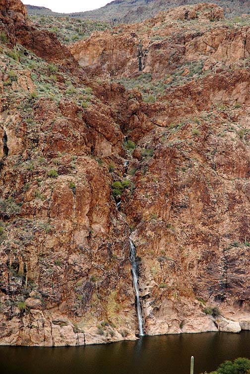 An ephemeral waterfall cascaded down a slot canyon and plunged into the lake.
 I could hear Willow Creek flowing down a steep arroyo below.
